Hi team,
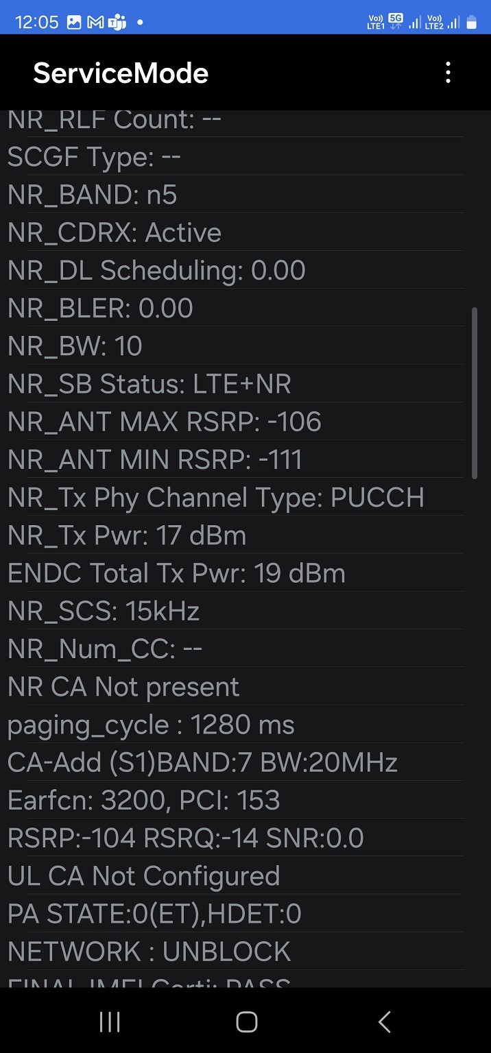
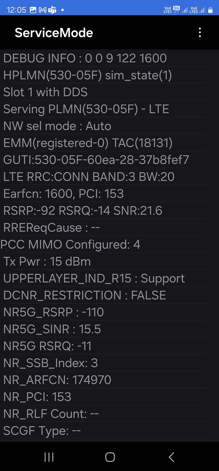
Has Spark started using band N5 (850mhz) with 5G?
According to the service menu on my Galaxy S23 Ultra, my local towers 5G is using N5:


|
|
I tested this with my SIM on an old phone of mine that supports only n78. No 5G (although tower reports NSA is available it doesn't connect to it).
Drove 10 minutes to nearby town and connected to N78 no problem.
I wonder how many more sites now have N5 active before the 3G shutdown?
Yeah, I’ve noticed a large part of Wairarapa (inc the south), as well as are large section between Levin and Palmy now on their coverage map - coverage that’s certainly not possible with N78 & N40 bands.
I used to use Network Cell Info Lite to see a map of this information (where the nearest cellsite was, etc), but sadly it hasn't worked for ages 😕
quickymart:
I used to use Network Cell Info Lite to see a map of this information (where the nearest cellsite was, etc), but sadly it hasn't worked for ages 😕
Gisgeek nor cellmapper map doesn't even list the tower as having 5g at all.
Ah, I was just having a poke around on GIS Geek to see whether I could find such a site, but failed. The filters don't seem to work correctly, which doesn't help (you choose 5G and 850, and it still gives you all the 3G sites).
Edit: Actually, I think the GIS Geek information comes from licences. The licence will be for 850 MHz, but whether it's 3G or 5G would be invisible to GIS Geek. I think, where the information is otherwise unavailable, it would just have to assume that 850 MHz is 3G, 3500 MHz is 5G, etc.
grantius:
Gisgeek nor cellmapper map doesn't even list the tower as having 5g at all.
I know about GISGeek, is cellmapper an app for your phone? I'm trying to find something similar to Network Cell Info Lite but there's not much similar out there.
quickymart:
grantius:
Gisgeek nor cellmapper map doesn't even list the tower as having 5g at all.
I know about GISGeek, is cellmapper an app for your phone? I'm trying to find something similar to Network Cell Info Lite but there's not much similar out there.
Yes it's an Android app. There's a map section on the app which shows a lot of uploaded statistics for discovered towers, it's really handy.
The celltower count in GIS geek tells about coverage.
OneNZ
2657
2Degrees
1906
Spark
1872
RCG
566
Uber
10
DenseAir
4
Just tried Cellmapper and it's okay, but I don't want it running constantly in the background when I'm not using it.
I reached out to the team who run Network Cell Info Lite and they said that (apparently) their app stopped working due to Mozilla location services no longer being supported. They said last August they were "working on a new feature to replace this" but as yet nothing.
A shame, as I really like their app and the layout is easy to understand 😕
|
|
