Handsomedan:
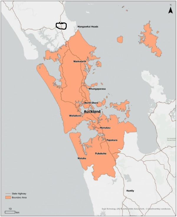
Based on a lot of this info, it does look like the checkpoints should have been further South (in the North).
Current placement makes it appear that you could take a couple of country back roads to Dargaville and escape the blockade. Not ideal...and probably not actually doable in practice.
The public health order is here:
https://www.legislation.govt.nz/regulation/public/2021/0006/latest/whole.html#LMS451773
The northern boundary of the Level 3 zone is clear. If the reports of police turning back people who haven't or weren't going to cross that boundary are accurate, then it appears that the police have overstepped.
From NZTA: "Please note additional NZ Police checkpoints are on Cove Rd, at Tangaroa Rd intersection, just north of Mangawhai - and at Mountain Rd on SH1, north of Kaiwaka. No alternative routes north/south are available."
If my map reading is correct, only the three listed road blocks are required to cut off north / south road access. It is actually a good location to pick for checkpoints if the Level 2 / 3 boundary was made to match.